


Footpaths around Papplewick Parish
Introduction.
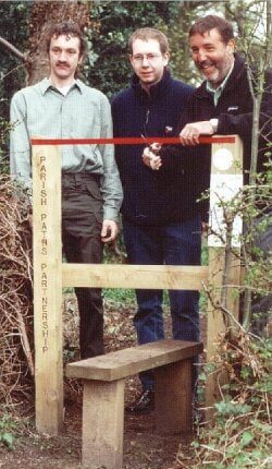
 In 1996 the ‘Linby and Papplewick parish paths partnership’ (P3) was created to maintain the footpaths and rights of way in the two parishes. Since then considerable work has been carried out – to upgrade the surface of the paths, provide stiles and waymarks, and to rebuild the ancient bridge over the River Leen. Funding from Nottinghamshire County Council and the Countryside Agency was used for the work to be carried out. Since 2010, all paths in Papplewick and Linby have been maintained directly by the County Council.
Maintenance.
More details about Rights of Way can be obtained from The County Council. You can report a problem here.
In 2005 the Parish Council revised the strategic plan for the development of footpaths in the parishes, covering the period 2005 to 2015. This available as as a MS-Word document or Adobe Acrobat. See below. Additional information can be obtained from the Clerk.
| To download ….. | |
| Paths strategy | Adobe Acrobat document |
The Routes.
 There are two linear footpaths running through the parish. These are known as the “Meadows Path” (which lies partly in Linby Parish) and the “Moors Path.” There is also a path leading north to Newstead Abbey and Ravenshead from Top farm, but only a short section (known as Hall Lane) lies within the parish. There are also concessionary paths through Moor Pond Wood, linked to the meadows which offer circular walks. The Robin Hood Way loops through the parish.
In 2000, our Millennium project was to create the Walters Hill link path.
The route was generously dedicated by the landowner and takes the Robin Hood Way from Top Farm, Papplewick to Newstead Grange. This allows pedestrians to avoid dangerous roadside verges along Blidworth Waye. The route was opened by Paddy Tipping MP on 21st April 2001.
The Meadows Path
The Meadows path is 1.0km (0.7 miles) long. You should allow 45 minutes for easy walking: (including return) : Map (if required): OS 1:25,000 explorer series sheet 28
This path links Papplewick and Linby. It begins near to the S-bend on Main Street, Papplewick adjacent to Papplewick Lodge at SK 548 514.
- Follow the narrow tarmac lane westwards (Church Lane) before turning left after 200m through a gate and onto a grass path close to the hedge (on your right).
- As the ground dips, turn right (after 100m) through a gap in the hedge. This extension path crosses a pasture northwards to St. James’ Church. If time allows, spend a while looking at the delightful 18th Century stone building in its secluded setting.
- Return to the path heading southwards, and back to the gap in the hedge, turning right towards Linby.
- From the bridge there is a footpath heading south into the Moor Pond Woods project area.
- After 130m, pass through the gate and onto an old stone bridge that crosses the River Leen. To the south of this bridge is the head of the old mill pond, now used for private fishing. To the north (right) is Mill Pond Plantation, which was felled and replanted in 1994. As we cross the river, we enter the parish of Linby.
- Follow the path westwards along the field headland. The field on the left was once a ‘Water Meadow’ and fed water into Papplewick Dam. The path joins Linby Lane at the eastern end of Linby village (SK 539 512).
The Moors Path
 This path is 2.2km (1.5 miles) long, so allow 1hr 30mins for easy walking (including return).
Map (if required) OS 1:25,000 explorer series sheet 28
This path joins Moor Road, Papplewick with the A60 Mansfield Road and begins on Moor Road at its junction with Papplewick Lane (SK 549 504). It is part of the Robin Hood Way, a long-distance footpath that runs through Nottinghamshire.
- Crossing the stile, the path heads across a large field in an easterly direction The first section is level, and used for arable farming, being known as Papplewick Moors. Notice the large pebbles in the silty soil. This was the bed of a lake when the glaciers were melting at the end of the Ice Age. The pebbles were washed down from the surrounding hills by melt water. In the First World War a 3,000ft. grass airstrip crossed these fields and was used as a reserve landing ground for aircraft from Hucknall aerodrome. From 1939 onwards, Tiger Moths of 25 Elementary Flying Training School based at Hucknall made dummy runs at it.
- The ground is poorly drained, and deep drainage channels have been cut to carry excess water from the fields. Heron are often to be seen in the channels, whilst the surrounding land echoes with the cry of Lapwing and Skylark in the spring and early summer. In late summer and autumn Geese may often be seen passing overhead, or browsing in the stubble.
- At the farm track junction, the path turns right and then immediately left to follow the line of timber poles towards the hedgerow.
- The path climbs steadily alongside the hedge. Watch out for Yellowhammer. At the summit, a good view may be had across Papplewick Parish towards the Leen Valley with Hucknall and Linby beyond. On a clear day, numerous local landmarks can be seen.
- On entering Stanker Hill farmyard, head diagonally right to pass along the right hand side of the buildings, soon reaching a stile. Cross the stile and follow the hedge round on your left to another stile (80m).
- Crossing this second stile, follow a narrow defined path with the railway in a cutting on your right hand side (at this point do not follow the path shown on the Ordnance Survey maps – it was diverted when the railway was built !).
- This higher land is where the harder pebble sandstone beds form the surface. Outcrops of the rock can be seen in the railway cuttings. The line was created in the early 1950’s to carry coal from Calverton Colliery to Bestwood. This section of the path was resurfaced in 1998. It is a profusion of wild flowers in spring and summer.
- After 440m you will enter Seven Mile Wood. This mixed woodland offers dappled shade in summer and shelter in winter. Listen for the drumming of the Woodpeckers.
- After a further 200m, the path climbs steps to reach the A60. Unfortunately, there is no other suitable alternative route to return to Papplewick, and you will have to retrace your steps, or turn right, then left at the traffic lights to visit the wooded delights of ‘Burnt Stump country park’.
The Robin Hood Way .
The Robin Hood Way is a long distance footpath within Nottinghamshire. It links Creswell, Clumber and Thoresby in the north of the County to Nottingham Castle in the south. The path runs through the parish in two loops.
From Ravenshead the path runs south into the parish via Kighill and down Blidworth Waye (Walter’s Hill) to the Papplewick Hall gates, then north-west along Hall Lane into the Newstead Abbey grounds, towards Nomanshill (Ravenshead).
The second loop links Papplewick Pumping station via Burnt Stump Country Park, and the Moors path to Bestwood.
The Hidden Valleys .
The Hidden valleys is the name given to the area of south Ashfield and north-west Gedling. This is an area of rolling landscape with good potential for footpath and woodland walking. There are a number of leaflets available from libraries and Council Offices. The leaflet which describes the routes in Papplewick can be downloaded here. (Beware: This is a large file and will be slow to download)